RAF HARROWBEER
YELVERTON
Dispersed Sites
As well as the main airfield, with it's buildings, runways and ancillary huts, there were twelve 'dispersed sites' scattered between Buckland Monachorum, Crapstone and the Airfield. The purpose of these was to house the Aircrews and Ground Staff away from the Airfiled, and thus be safer in the event of an enemy attack. The sites ranged from small groups of eight to ten huts, ranged in the corners of fields, to larger 'communal sites' with dining halls, shower blocks etc.
After the war, most of the sites were converted for use as 'emergency housing'. These were (we've been told) much sought after and felt to quite 'palatial' compared to some of the housing stock. One tale related to us is of a schoolgirl, returning home on the bus, overhearing a conversation that so and so had moved out and that one of the huts was thus vacant. She told her Mother who went into the Council the following day and demanded to be rehoused! And got it!. With an internal bathroom, they were quite something! When council house building began to replace the huts, they were cleared away, leaving just the odd hut base here and there. The conversion consisted of dividing them roughly in half, with two bedrooms, kitchen/diner, front room and bath room (with toilet) at one end and the same at the other, but with only a toilet. The bath was hidden under the kitchen table. (A floor plan will be added shortly)
We would be interested to hear from any former inhabitants of these huts, and to see any family photographs taken in and around them.
The main Communal Site in Crapstone was used by the MOD for many years as an extension to Devonport Dockyard. It was finally disposed of in the late 1980s and cleared for housing.
In all, Harrowbeer consisted of thirteen 'sites'. Site No 1 was the Airfield itself, Site No 2 was the Communal Site, Site No 3 was the WAAF Site, Site No 4 was the Sick Quarters, Site Nos 5, 6, 7, 8, 9, 10, 11, & 12 were all for Pilots and ground Crews, finally, Site No 13 was (still is) the Sewage Treatment Works (which I won't show here).
Please do not explore any of the sites below without first approaching the Landowner!
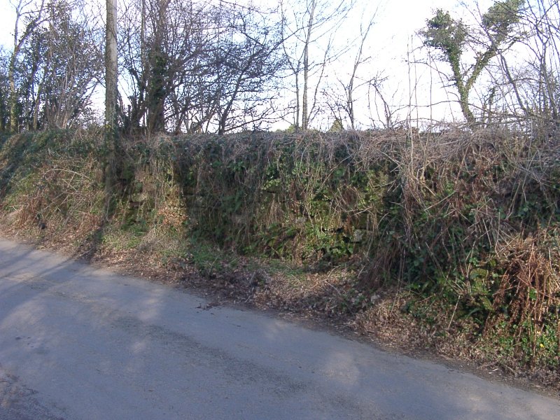
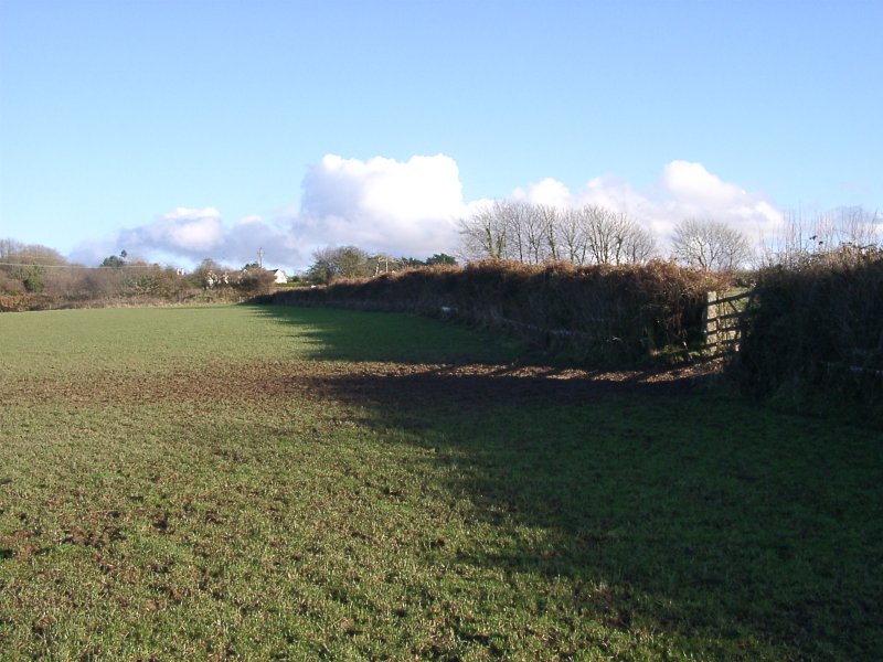
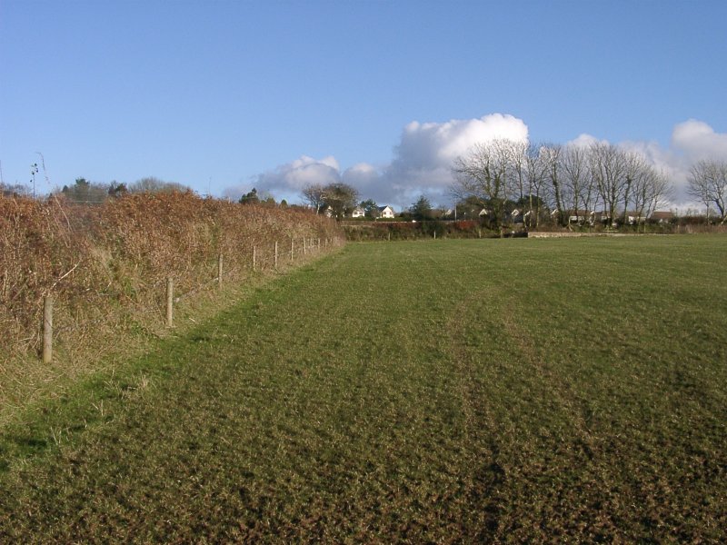
Of the above, (apart from sites 1 & 2) Site No 3 is on Private property but can be viewed from its entrance gate. It has been cleared of all buildings but a couple of hut bases remain. Site No 4 is now the Yelverton Business Park. The former hospital buildings remain standing, (although now extended) as business units. A plaque recording their former use is affixed to the wall of one of them. Site No 5 has been completely cleared and is visible only from the nearby road. Site No 6 is on Private Property and cannot be viewed. Site No 7 (completely cleared) and Site No 8 (one hut base remaining) are viewable from the public footpath. Site No 9 (completely cleared) is viewable from the main road between Buckland Monachorum and Crapstone. Site No 10 (two bases remaining) can also be seen from the same footpath, (as above) but it is on the opposite side of the field. Site No 11 is on Private Property but some of it can be viewed from the public footpath between The Garden House and Crapstone. Site No 12 has been cleared and is on Private Property.
Site No 2 ~ Communal Site |
 |
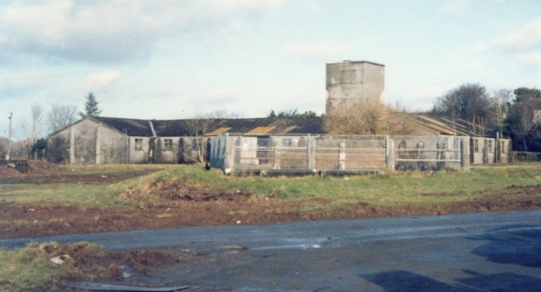
A panaramic view of the lower part of the Communal site, taken shortly before demolition. The site is now a housing estate and playing fields. |
|
A view down the lower left side, shortly before clearance. The large huts were built on the site of a former fuel store. The small building on the left is the 'Barbers, Tailors & Shoemakers Shop'. |
 |
 |
Looking North from roughly the same position as above. In the foreground is a fenced-in Static Water Tank and behind is the 'Ablution, Shower & Changing Block' |
|
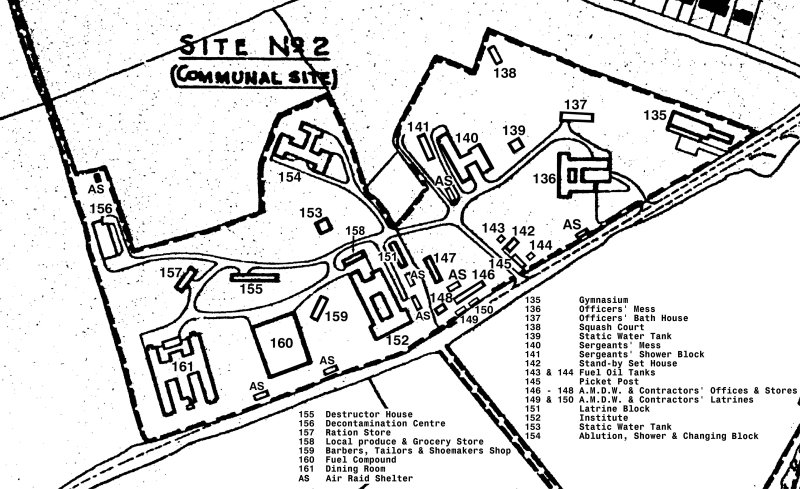
Detailed map of the (former) Communal Site in Crapstone. The area has been completely cleared and replaced with housing and a playing field. |
 |
|
|
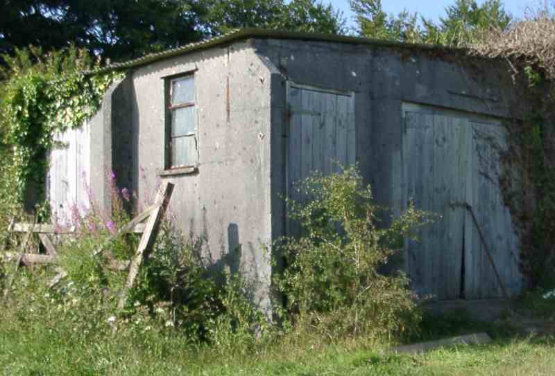
Picket Post The entrance to every Dispersed Site was guarded by one of these concrete Picket Posts. This is one of only two known to be left standing. It is on Private Property and not for public viewing. |
Site No 3 |
|
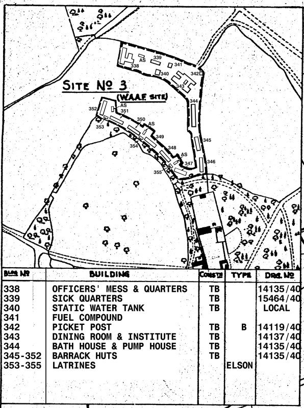
General Map of Site No 3 ~ WAAF Site The WAAF site was quite a distance from the where the Pilots and Ground Crews were billeted! Only a couple of bases remain today (342, 343 and part of 338), although we haven't done a full survey. |
 |
 |
Looking left into Site No 3 from the entrance way. The base on the left is the base of the Picket Post. Note the tarmac roadway still in situ. The base beyond is for the Dining Room & Institute. The local Farmer uses the area as a silage store. |
|
Looking right into Site No 3 from the entrance way showing the rest of the base of the Dining Room & Institute. |
 |
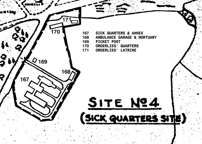
Site No 4 |
|
General Map of Site No 4 Most of this site has been turned into the Yelverton Business Park. The main Hospital building remains though (but extended). Photos to be added in due course |
 |
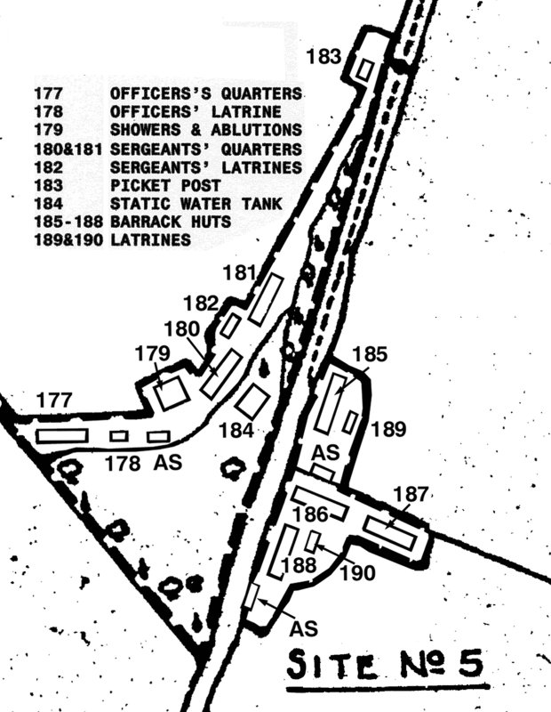
Site No 5 |
|
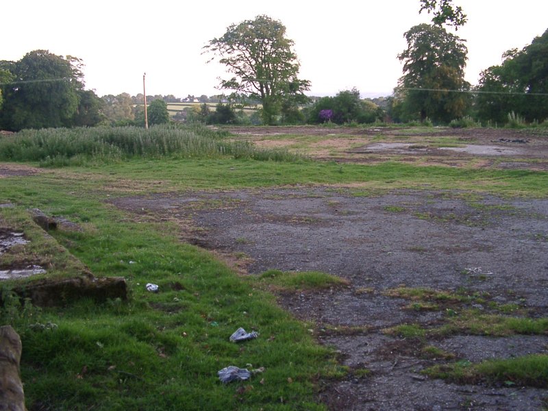
General Map of Site No 5 Nothing remains of this site, part of which is within the grounds of the local Golf Driving Range and the rest was in fields opposite. We know that 193 Squadron were billeted here for a while in 1943. |
 |
 |
The 'bricked' up entrance to Site No 5. There appears to be no trace of the buildings on the other side of the road which is within the local Golf Driving Range |
|
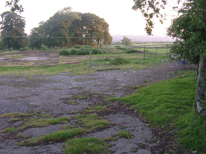
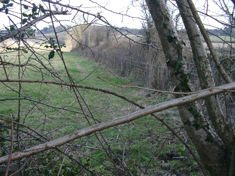
The view over the hedge (1). There should be an Air Raid Shelter and base 185 here. |
 |
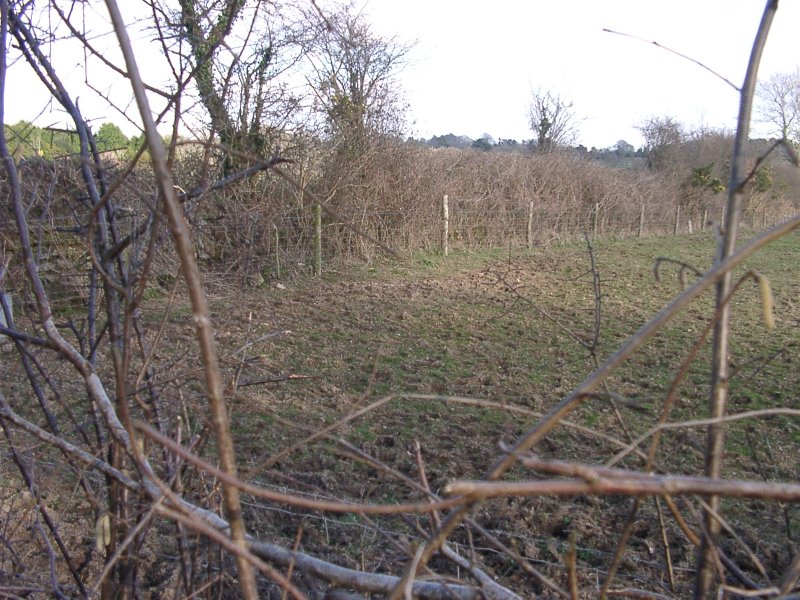 |
The view over the hedge (2). Hut bases 186 & 187 should be here. |
Site No 6 |
|
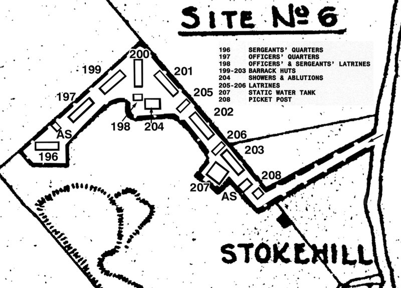
General Map of Site No 6 This site is on Private Property so I will not be posting photos. Please do not enter the site!. There is one hut base and the Picket Post remaining. |
 |
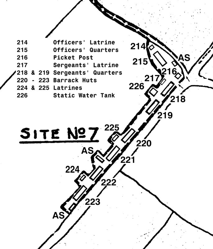
Site No 7 |
|
General Map of Site No 7 Nothing remains of this site. The footpath
from Buckland Monachorum runs across the top of the site (and behind
the hedge). It is visible through the gate (picture 2) and from the
main road (picture 1). |
 |
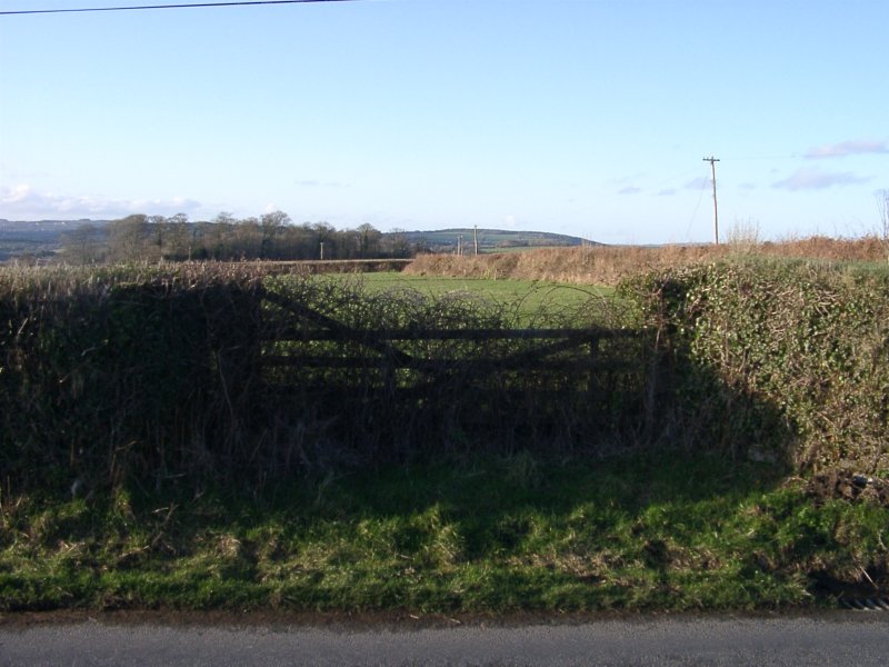 |
Looking from the road through the entrance gate. The picket post (216) would have been just inside the gate. |
|
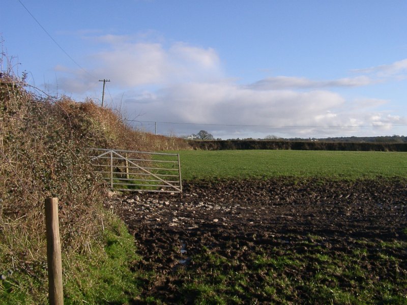
This may have been a 'rear' entrance gate to the site. The Farmer tells me that the all the sites were connected by a surfaced roadway. The gate in picture 1 (above) is in line with the tree in the distance. |
 |
Site No 8 |
General Map of Site No 8The site can be viewed from the footpath (shown dotted on the map). Only one hut base remains (no 240). |
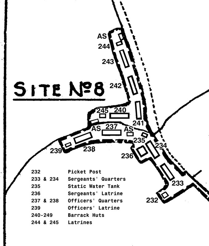 |
 |
View of site 8Looking towards where Huts 241, 242 etc |
The remaining hut base on site 8, showing the steps which once lead to the entrance to hut 240 |
 |
 |
The entrance to Site 8 (on the right) looking towards where Hut 233 would have been. |
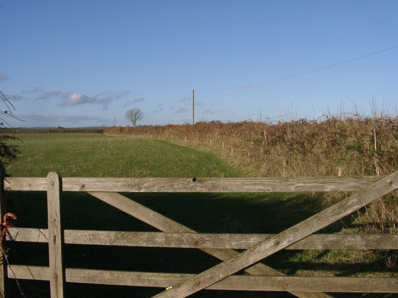
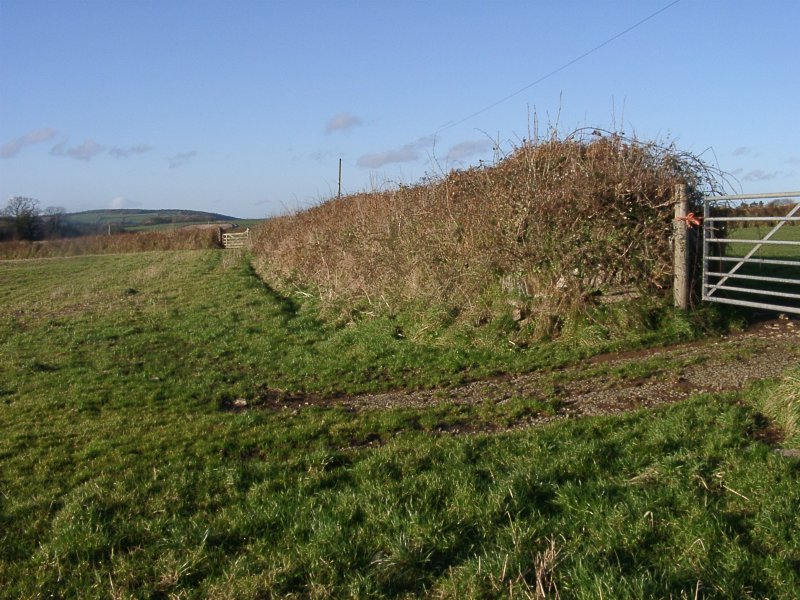
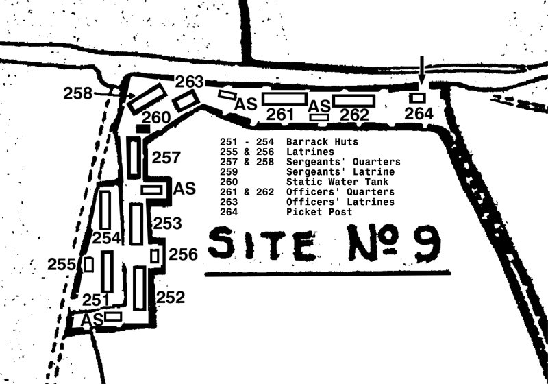
Site No 9 |
General Map of Site No 9Although the site can be viewed from the main road, the track (shown dotted) is private. The public footpath from Buckland Monachorum takes you above Site No 9 (and thus you can look down over it from a distance) and near to Site No 10. |
 |
 |
There is no trace of Site No 9, which was on both sides of the hedge (left) and off to the right against the far hedge. The local farmer remembers his father demolishing the site after the War. In the far corner of the field (to the right of the pointed tree) he says he still hits the base of the static water tank, (left in the ground) with the plough!. |
|
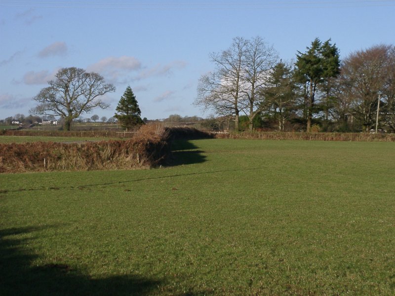
On the other side of the hedge (where huts 254 & 251 would have been) showing the linking gateway. My Wife is standing on the corner of hut base 254 which just shows above ground as a few bricks. |
 |
 |
Looking in the entance gateway of Site No 9 (where the arrow is on the map). Alongside the hedge here (and leading to Site No 10 against the hedge in the distance) was a tarmac road. Visitors would turn right in to Site No 9 here, go past the Picket Post and on, into the site. |
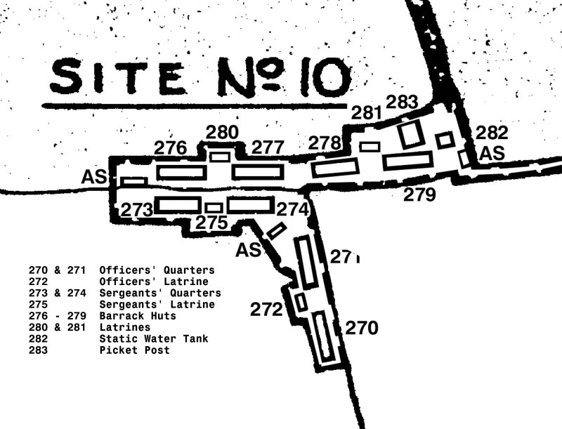
Site No 10 |
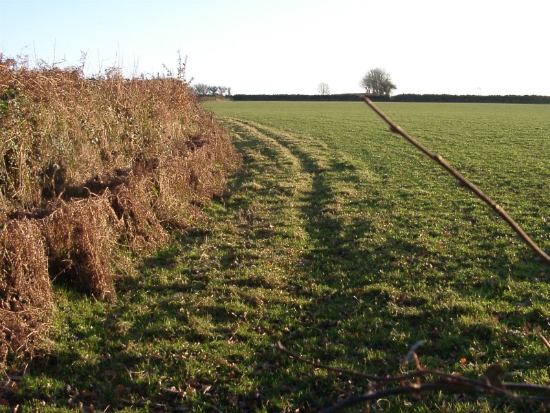
General Map of Site 10The footpath from Buckland Monachorum runs along the hedge to the left of this map (which isn't shown). Only bases 270 & 271 remain. The huts on them were lived in after the war by farm workers. |
 |
 |
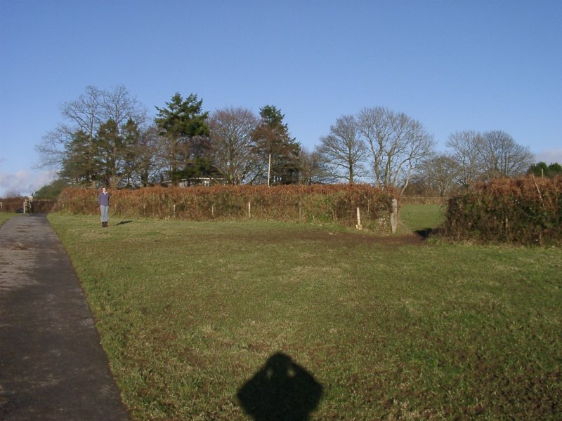
The lower side of the hedge which runs through the middle of Site No 10. Hut 276 would have been directly if front of us (by the gate). In the far corner is a mound of rubble - the crushed remnants of an air-raid shelter. |
|
The upper side of the hedge. Hut 273 would have been in front of us here. In the right distance, hut base 271. |
 |
 |
The bases of huts 270 (nearest) and 271. As mentioned, these huts remained standing after the War and were lived in by farm workers. After demolition the bases were left and now the farmer finds them useful for feeding the sheep and cows. The pallet in the background blocks a tiny acess gateway. |
General Map of Site No 11The footpath
shown running diagonally across the site has moved, because a house
has been built between the site and the road. However, several buildings
remain, and are visible from the re-aligned footpath. |
 |
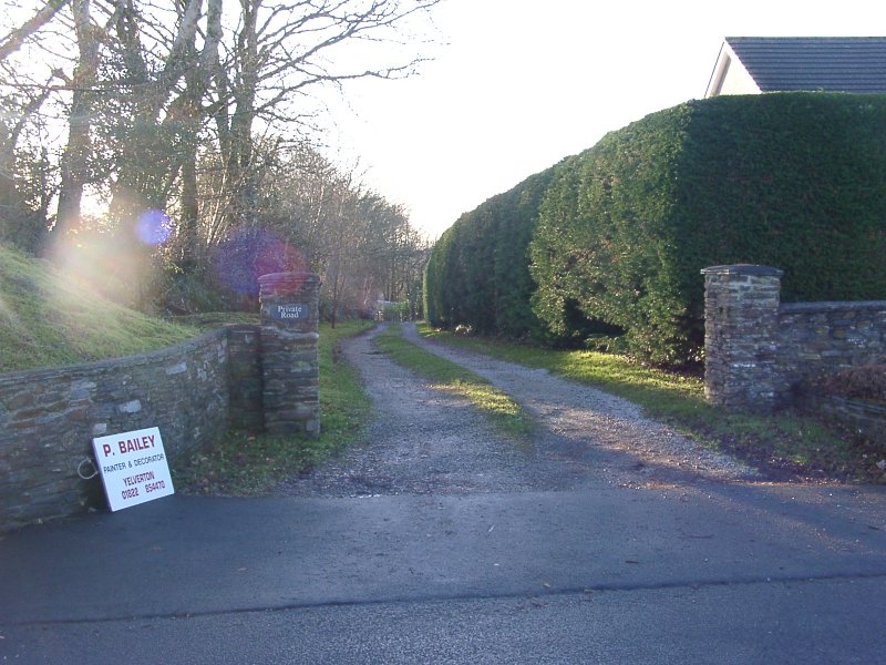 |
The entrance to Site No 11 looking from the main road. The new house is visible on the right. This is private property and there is no access to the site. |
|
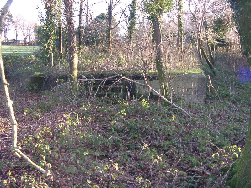
The remains of hut base 289. As on Site 8, the steps to the front door are still visible. The remains of other building are hidden by the undergrowth in the background. |
 |
 |
The standing remains of one of the Latrines (293 & 294). |
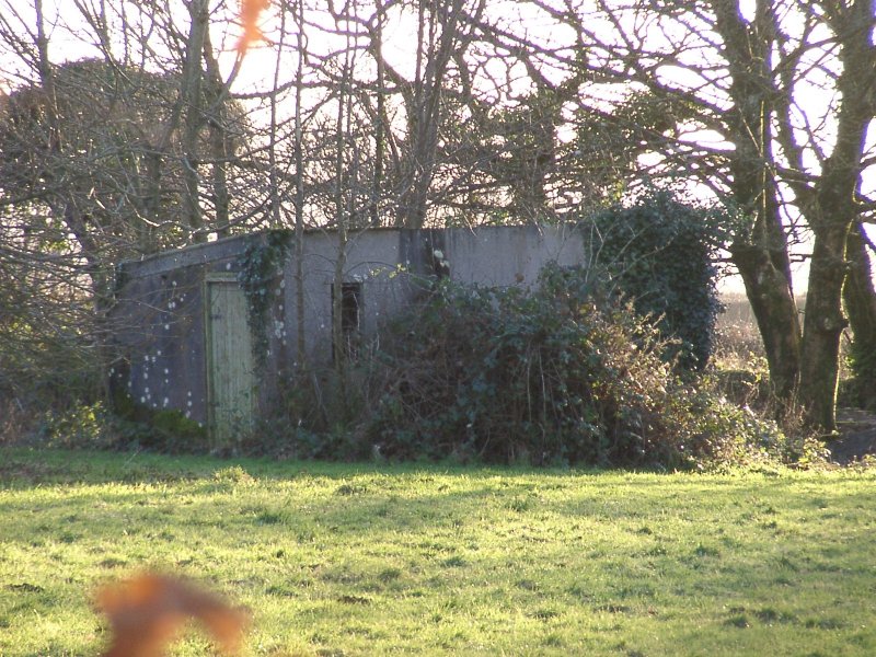
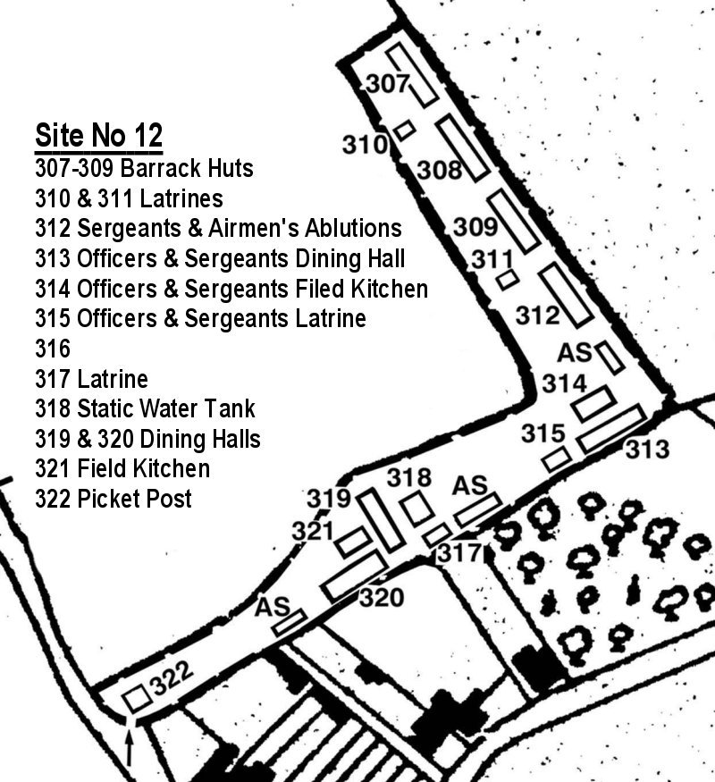
Site No 12 |
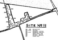
General Map of Site No 12This site appears to have been were Aircrew showered and took their meals, as there are no sleeping quarters here. Quite how this fitted in with Site No 2 and its facilities - Pass! I bet someone out there knows? |
 |
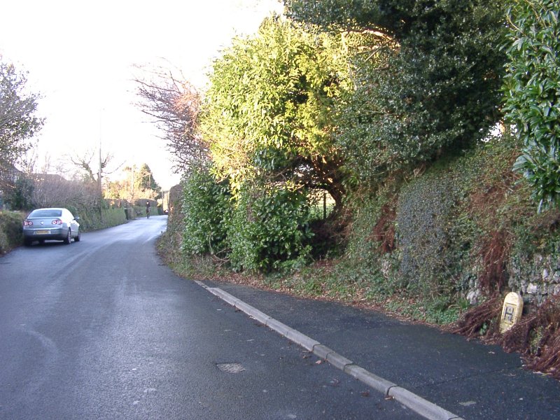 |
The entrance
to Site No 12 is still just visible off the side of the main road through
Crapstone, (looking towards Buckland Monachorum). The entrance to Site
No 11 is beyond the car (left).
|
|
After fighting through the undergrowth in the entrance path(!) only one hut base (now adapted to hold a power transformer) appears to be visible. |
 |